Contract signed for the Stena IceMAX drill-ship
24 November 2016
Planned spud date at the FEL Licence 2/14 for the 53/6-A exploration well is June 2017
SOSINA Exploration Ltd today provides an update on the Frontier Exploration Licence ("FEL") 2/14 drilling project, which lies in c. 2,250 metre water depth in the southern Porcupine Basin and is located c. 220 kilometres off the south west coast of Ireland. The licence is operated by Providence Resources P.l.c. ("Providence") (80%) on behalf of SOSINA (20%), collectively referred to the "JV Partners". FEL 2/14 contains the Paleocene "Druid" and the Lower Cretaceous "Drombeg" exploration prospects.
Stena IceMAX Rig Contract
On behalf of the JV Partners, Providence has signed a contract for the provision of a Harsh Environment Deepwater Mobile Drilling Unit (the "Contract") with Stena Drillmax Ice Limited ("Stena"), a wholly owned subsidiary of Stena International S.A., for the Stena IceMAX drill-ship. The Stena IceMAX is a modern harsh environment dual derrick drill-ship designed to operate in water depths of up to c. 3 km. The Contract provides for one firm well, plus an additional option, which is electable at the discretion of the JV Partners for the drilling of a second follow-on well. The operational rig rate is $185,000 per day.
In addition to the finalisation of the Contract, other key service contracts are now being prepared for the planned drilling operations. Based on the latest project timeline and, subject to standard regulatory approvals and consents, the 53/6-A exploration well is currently planned to spud in June 2017.
About Stena Drilling
Stena Drilling is one of the world's leading companies in the development, construction and operation of offshore drilling rigs and drill-ships. Stena's fleet consists of four ultra-deep-water drill-ships and three semi-submersible rigs.
|
|
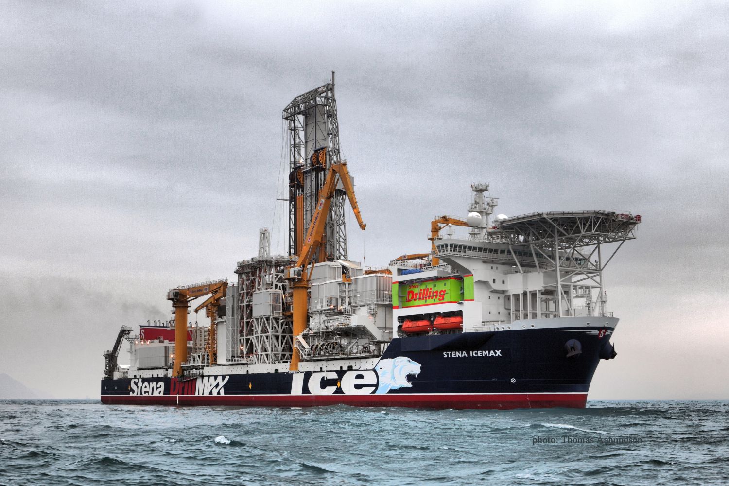
Stena IceMAX is the world's first dynamically positioned, dual mast ice-class drillship. The Stena IceMAX is a Harsh Environment DP Class 3 drillship capable of drilling in water depths up to 10,000ft. The IceMAX has on-board 2 x BOP's, each 18¾" x 15,000psi Cameron "TL" BOP c/w ST Locks, and uses Cameron Load King riser. The vessel was delivered in April 2012.
About FEL2/14 - Druid & Drombeg
During the initial pre-FEL 2/14 authorisation phase (Licensing Option 11/9 - 2011 through 2013), Providence and SOSINA identified two large vertically stacked Paleocene (?Druid') and Lower Cretaceous (?Drombeg') fan systems with notable Class II amplitude versus offset ("AVO") anomalies primarily from 2D seismic data acquired in 2008. Providence and SOSINA subsequently agreed to underwrite a multi-client 3D seismic survey over the area. This 3D survey was acquired by Polarcus in the summer of 2014 and subsequently processed by ION Geophysical in 2014/15. In September 2015, Providence and SOSINA entered into a Strategic Exploration Collaboration Project with Schlumberger. In April 2016, the main results of this Project were announced:
Druid (Paleocene)
- Two fans located c. 1,750 m BML and structurally up-dip from a potential significant fluid escape feature from the underlying pre-Cretaceous Diablo Ridge.
- Cumulative in-place un-risked prospective resources of 3.180 BBO (PMean).
o Fan 1 - 984 MMBO (PMean).
o Fan 2 - 2,196 MMBO (PMean).
- Pre-stack seismic inversion and regional rock physics analysis shows Druid is consistent with a highly porous (30%) and high net-gross, light oil-filled sandstone reservoir system up to 85 metres thick.
- A depth conformant Class II AVO anomaly is present and synthetic forward modelling of an oil-water contact correlates with the observed seismic response.
- Spectral decomposition, seismic compactional drape and mounding are reflective of a large sand-rich submarine fan system with no significant internal faulting and clear demonstration of an up-dip trap mechanism.
- Geomechanical analysis using regional well and high resolution seismic velocity data indicates that Druid is normally pressured and the top seal is intact.
Drombeg Prospect (Lower Cretaceous)
- Located c. 2,750 m BML and structurally up-dip from a potential significant fluid escape feature from the underlying pre-Cretaceous Diablo Ridge.
- In-place un-risked prospective resource of 1.915 BBO (PMean).
- Pre-stack seismic inversion and regional rock physics analysis shows Drombeg is consistent with a highly porous (20%), light oil-filled sandstone reservoir system up to 45 metres thick.
- A depth conformant Class II AVO anomaly is present and spectral decomposition is reflective of a large sand-rich submarine fan system with no significant internal faulting, and supports an up-dip trap mechanism.
- Geomechanical analysis using regional well and high resolution seismic velocity data indicates that Drombeg is over-pressured with an intact top seal.
| Contact: |
Mr. John Ødegaard, Chairman of the Board Mobile: +45 27 26 00 03 |
« Back